Pegase Application : Chiers River (Meuse IHD)
| Year of design: | 2002 |
|---|---|
| Description: | After a succesful test of trans-national simulation realised on the Chiers river (2 200 km², Meuse River tributary), the Wallonia Public Service (SPW, Be) initiated, in collaboration with the French Water Agency Rhine-Meuse (AERM, Fr), the Administration for Water Management of the Grand-Duchy of Luxemburg (AGELux, Lu) a request to the Aquapole (in 2005) to develop a trans-national application of the Pegase model on the upstream part of the Meuse River (down-to the Dutch border). This application was extended from 2008 to 2010 to the whole international district of the Meuse River, with new stakeholders: The "Vlaamse Milieumaatshappij" (VMM, Be), the "Ministerium für Umwelt und Naturschutz des Landes Nordrhein-Westfalen" (MUNLV, De) and the "Rijkswaterstraat" (RWS, Nl). The application covers a watershed of 35&nbps;140 km², for 13 560 km of rivers (1 319 rivers) spread as follows: -
|
| Basin View*: |
![]() |
| Competent Authority: | SPW, AERM & AGELux |
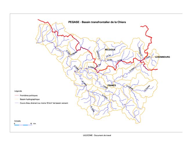
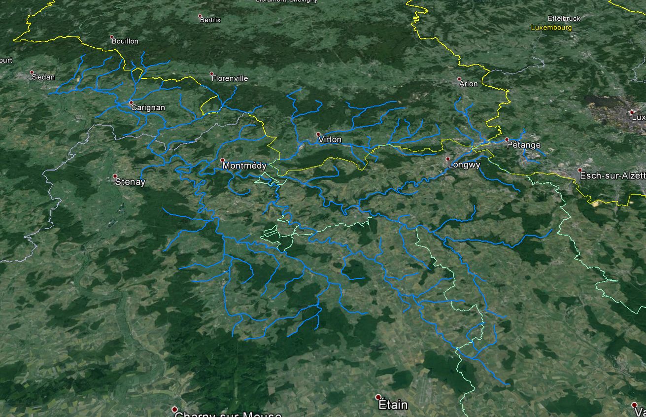
| Watershed: | 2225 km2 |
| Rivers: | 82 (842 km) |
| Pegase Nodes: | 4300 |
| History: | Current Basin Meuse River 2005 |
* Images realised with Google-Earth™ and ArcGIS™
Aquapole